Diskan-MI Mobile interactive system for large scale documents digitizing
Diskan-MI Mobile interactive system for large scale documents digitizing
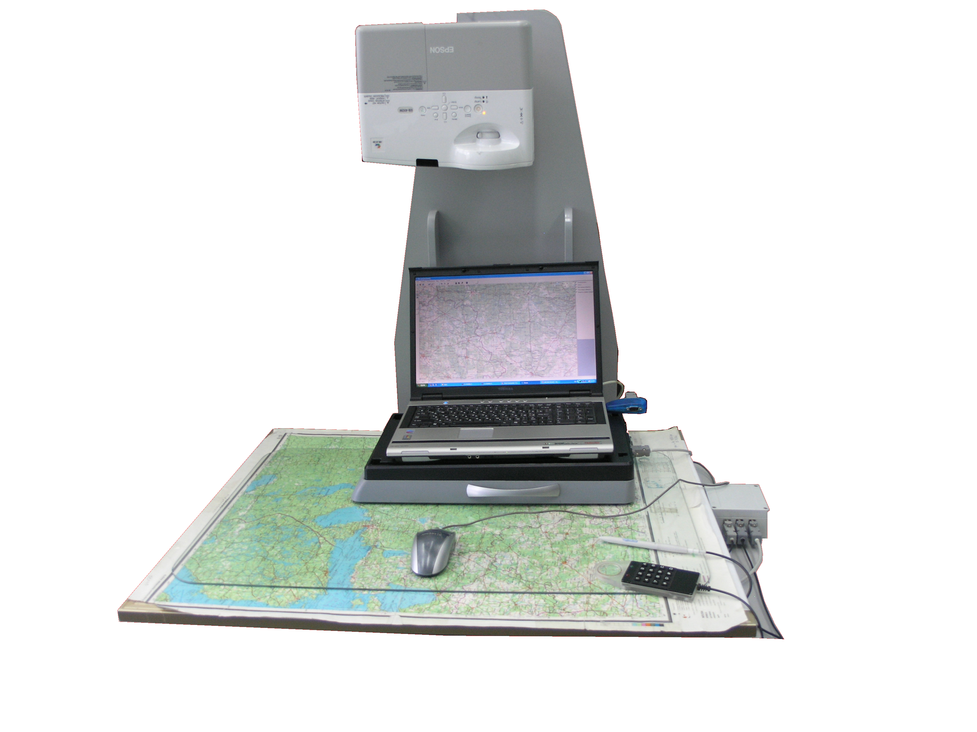
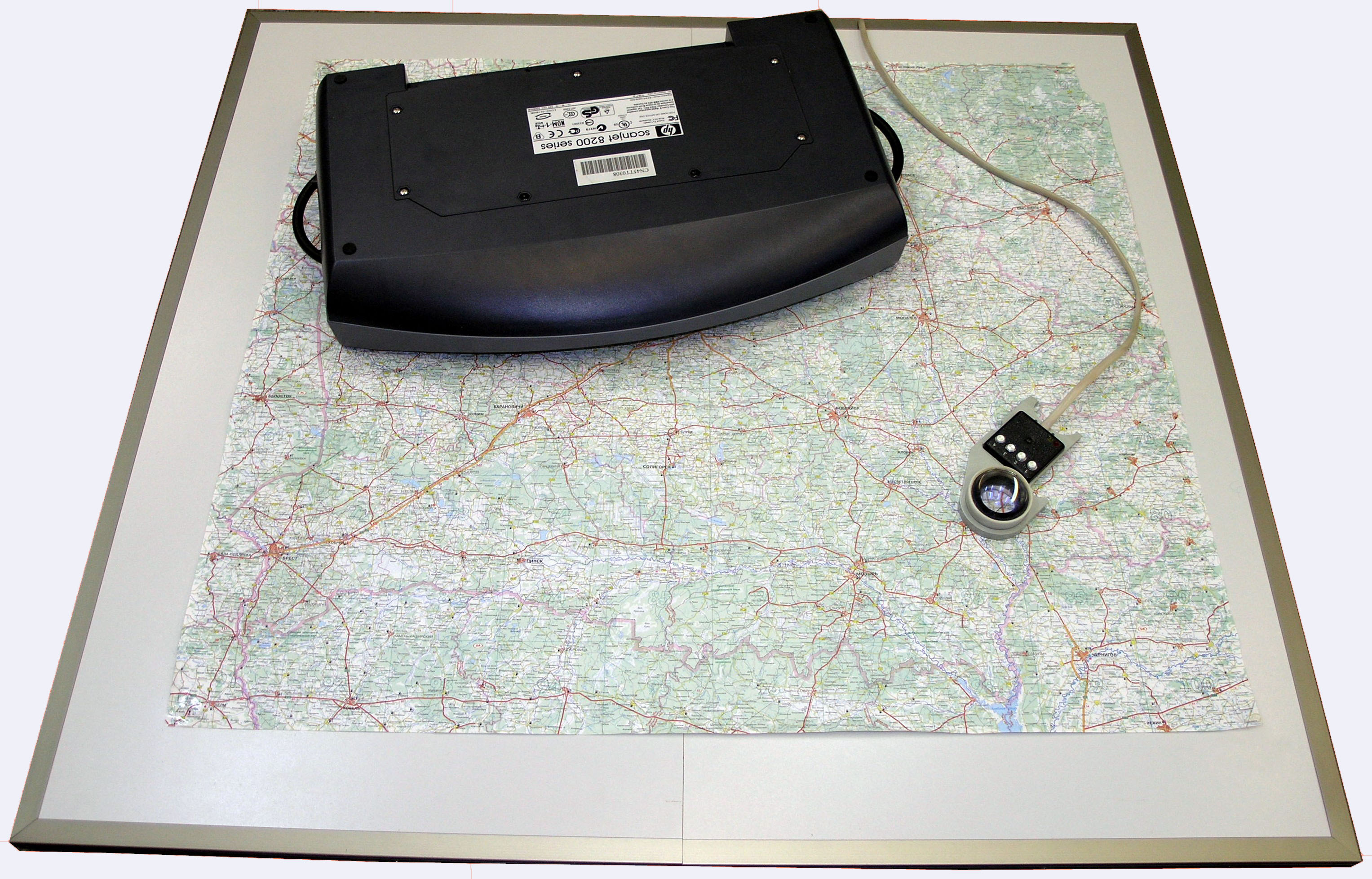
Sectional magnetic (folding) digitizer for mobile and stationary application.
Mobile hard-software complexes and technologies of fragmentary input (digitizing) the graphic documents of arbitrary size and different color characteristics.
Principal researcher: Gert I. Alekseev;
Key words: Discan-M, cartography, scanning;
Field of application: cartography, geodesy, municipal services;
Brief description, main features: Fragmentary input of wide-screen documents from hard and flexible mediums. Windows XP (and newer) OS, 300-600 dpi scan resolution, size A0 scan time takes 15-20 minutes. Topographic plan scan time takes no more than 5 minutes.
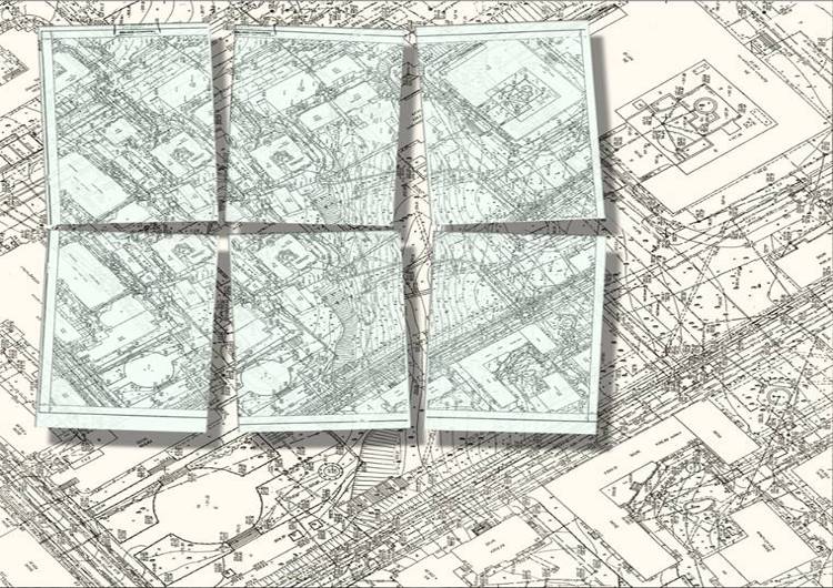
· Fragmentary scanning the graphic documents (maps, top plans, engineering drawings, etc)
· Creation of combined (raster + vector) digital copy of a document (copy);
· Drawing additional information over digital layers;
· Visual representation of input procedures to control, to edit, to print and to export digital data for stationary application;
· Input and representation of lines, polygons, curves, arches and different geometric figures;
· Control of geometric primitives;
· Vector templates of images (arrows, buildings, equipment, etc. Electronic eraser)
CHARACTERISTICS
|
Working area
|
Number of fragments in one installation
|
Period of scanning
|
Full time of raster copy producing
|
|
1700x1500
|
48
|
25
|
30
|
|
1400x1200
|
24
|
12
|
15
|
|
1200x840
|
16
|
8
|
15
|
|
500x500
(topoplan)
|
6
|
3
|
5
|
Novelty: The product has no analogues in CIS countries. With 300 dpi scan resolution canned fragments matching accuracy is 1-2 px.
Degree of product availability: Experimental model with Discan-M system documentation package has been designed.
Instrument for cooperation: Execution of works on contractual basis i
The product implementing:
· The creation of digital maps and plans of terrain by paper or film maps and plans for the sake of Ministry of Extreme Situation, Ministry of Defense and other organizations and ministries;
· The transformation of the documents in scientific-engineering institutes, designing departments and other institutions from paper graphic form into digital form ;
· Digitizing the great amount of archive documents (city plans, schemes, diagrams, etc) stored in the cartoon and metal carriers of 600x600 mm size, which could not be scanned by roll-up large format scanners;
· In cadastre systems (city, land cadastre and others);
· Integration with large format interactive boards to organize the teaching process, presentation, seminars, business meetings, etc.
Cost: about 900Eiro
Contacts: academic secretary – Oleg V. Gorokh, tel.: 8 (017) 284-21-76; principal investigator –
Gert I. Alekseev tel.: 8 (017) 284-21-60.